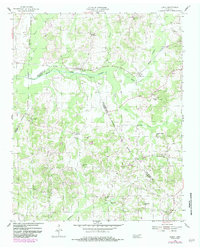
1955 Map of Luray
USGS Topo · Published 1984About this map
The North Fork Forked Deer River meanders across this landscape, defining the character of a rural West Tennessee region where three counties — Madison, Henderson, and Chester — meet. Small settlements like Luray and Huron serve as focal points along the river valley, while Mifflin anchors the central terrain. The map reveals a dense network of community infrastructure typical of the mid-20th century, notably several country schools such as Cawthon Sch, New Friendship Sch, and Olive Grove Sch.
Find a feature on this map
28 named features on this map. Tap any name to fly to it.
Don’t see what you’re looking for? This feature index may not catch every label — zoom into the map to look around manually.
Map Details
Editions of this 1955 Luray Map
2 editions found
Other maps of this area

1936 · Lexington
USGS Topo · 1:24,000

1936 · Enville
USGS Topo · 1:24,000

1936 · Life
USGS Topo · 1:24,000

1950 · Life
USGS Topo · 1:24,000

1950 · Enville
USGS Topo · 1:24,000

1950 · Lexington
USGS Topo · 1:24,000

1953 · Claybrook
USGS Topo · 1:24,000

1953 · Beech Bluff
USGS Topo · 1:24,000

1955 · Luray
USGS Topo · 1:24,000

1955 · Juno
USGS Topo · 1:24,000