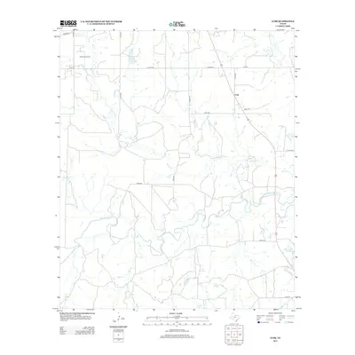
2012 Map of Lusk
USGS Topo · Published 2012About this map
The Woodson Oil Field and the small settlement of Lusk define this corner of Throckmorton County, where energy extraction meets traditional Texas ranching country. The landscape is deeply carved by the meandering Clear Fork river and its many tributaries, including Givens Cr and Buck Br, which create a complex drainage pattern through the lowlands. In the eastern reaches, the Lester Clark Reservoir provides a critical water source in an area otherwise dominated by seasonal creeks and intermittent streams like Kings Cr. A grid of county roads, such as Hughes Rd and Dickie Rd, connects isolated homesteads and drilling sites, reflecting the late 20th and early 21st-century rural infrastructure of the Texas Rolling Plains.
Find a feature on this map
24 named features on this map. Tap any name to fly to it.
Don’t see what you’re looking for? This feature index may not catch every label — zoom into the map to look around manually.
Map Details
Editions of this 2012 Lusk Map
This is the sole edition of this map. No revisions or reprints were ever made.
Other maps of this area

1890 · Breckenridge
USGS Topo · 1:125,000

1892 · Albany
USGS Topo · 1:125,000

1893 · Albany
USGS Topo · 1:125,000

1954 · Abilene
USGS Topo · 1:250,000

1954 · Wichita Falls
USGS Topo · 1:250,000

1958 · Wichita Falls
USGS Topo · 1:250,000

1958 · Abilene
USGS Topo · 1:250,000

1958 · Breckenridge
USGS Topo · 1:24,000

1958 · Edwards Branch
USGS Topo · 1:24,000

1965 · Lusk
USGS Topo · 1:24,000