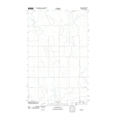
2011 Map of Lustre
USGS Topo · Published 2011About this map
The small settlement of Lustre anchors this portion of Valley County, situated at a junction of rural routes that facilitate the region's agricultural life. The landscape is defined by the branching drainage systems of several significant waterways, including West Fork Wolf Creek, Middle Fork Wolf Creek, and Cottonwood Creek, which carve subtle topography through the plains. Transportation and community access are well-documented through a network of named section-line roads such as Lustre Rd and Academy Rd.
Find a feature on this map
16 named features on this map. Tap any name to fly to it.
Don’t see what you’re looking for? This feature index may not catch every label — zoom into the map to look around manually.
Map Details
Editions of this 2011 Lustre Map
This is the sole edition of this map. No revisions or reprints were ever made.
Other maps of this area

1910 · Todd Lakes
USGS Topo · 1:62,500

1915 · Todd Lakes
USGS Topo · 1:62,500

1915 · Spring Creek
USGS Topo · 1:62,500

1954 · Wolf Point
USGS Topo · 1:250,000

1954 · Glasgow
USGS Topo · 1:250,000

1957 · Glasgow
USGS Topo · 1:250,000

1958 · Wolf Point
USGS Topo · 1:250,000

1958 · Glasgow
USGS Topo · 1:250,000

1973 · Haugens Hill
USGS Topo · 1:24,000
1973 · Blink Springs
USGS Topo · 1:24,000