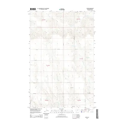
2014 Map of Lustre
USGS Topo · Published 2014About this map
Lustre serves as the focal point for this section of Valley County, situated within the Frazer District during the early 21st century. The landscape is defined by the drainage networks of Cottonwood Cr and the various branches of Wolf Creek, including W Fork Wolf Cr and Middle Fork Wolf Cr. This area of the Missouri Plateau displays a transition from traditional land use to localized infrastructure, such as Saubak Airport and a grid of rural roads like Lustre Rd and Academy Rd. The presence of MB Church Rd and 31N45E16CBDB01 Spring provides specific points of interest for those tracking local community hubs and water sources. Elevations are further articulated by features such as Tree Coulee, which cuts through the high plains terrain north of the Missouri River valley.
Find a feature on this map
23 named features on this map. Tap any name to fly to it.
Don’t see what you’re looking for? This feature index may not catch every label — zoom into the map to look around manually.
Map Details
Editions of this 2014 Lustre Map
This is the sole edition of this map. No revisions or reprints were ever made.
Other maps of this area

1910 · Todd Lakes
USGS Topo · 1:62,500

1915 · Todd Lakes
USGS Topo · 1:62,500

1915 · Spring Creek
USGS Topo · 1:62,500

1954 · Wolf Point
USGS Topo · 1:250,000

1954 · Glasgow
USGS Topo · 1:250,000

1957 · Glasgow
USGS Topo · 1:250,000

1958 · Wolf Point
USGS Topo · 1:250,000

1958 · Glasgow
USGS Topo · 1:250,000

1973 · Haugens Hill
USGS Topo · 1:24,000
1973 · Blink Springs
USGS Topo · 1:24,000