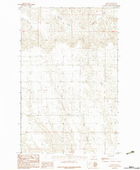
1983 Map of Lustre
USGS Topo · Published 1983About this map
West Fork Wolf Creek and Middle Fork Wolf Creek converge in this high-plains landscape, where the drainage patterns illustrate the intricate topography of northeastern Montana. The area is characterized by a network of seasonal watercourses and coulees, including the winding Tree Coulee and Cottonwood Creek. In the northwest corner, the East Fork Porcupine Creek cuts through the terrain, highlighting the transitional water systems that define the rural Valley County interior. This 1983 provisional survey captures the region's land divisions and natural drainages before significant modern development, providing a clear view of the section lines and township boundaries that shaped local land use and agricultural planning in this part of the state.
Find a feature on this map
8 named features on this map. Tap any name to fly to it.
Don’t see what you’re looking for? This feature index may not catch every label — zoom into the map to look around manually.
Map Details
Editions of this 1983 Lustre Map
This is the sole edition of this map. No revisions or reprints were ever made.
Other maps of this area

1910 · Todd Lakes
USGS Topo · 1:62,500

1915 · Todd Lakes
USGS Topo · 1:62,500

1915 · Spring Creek
USGS Topo · 1:62,500

1954 · Wolf Point
USGS Topo · 1:250,000

1954 · Glasgow
USGS Topo · 1:250,000

1957 · Glasgow
USGS Topo · 1:250,000

1958 · Wolf Point
USGS Topo · 1:250,000

1958 · Glasgow
USGS Topo · 1:250,000

1973 · Haugens Hill
USGS Topo · 1:24,000
1973 · Blink Springs
USGS Topo · 1:24,000