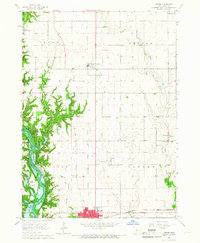
1965 Map of Luther
USGS Topo · Published 1967About this map
The Saylorville Reservoir Des Moines River defines the western landscape of this mid-1960s Iowa survey, illustrating a period of significant hydrological management and recreational development. East of the river, the small community of Luther serves as a central hub for the surrounding agricultural townships of Worth, Colfax, and Douglas. The map is particularly rich in civic and religious landmarks, featuring numerous burial grounds like Rose Hill Cem and Cassel Cem, alongside the Garden Prairie Ch. Public land use is prominent, as evidenced by the State Game Farm, Ledges State Park, and the State 4-H Camp. The transportation and research infrastructure of the era is anchored by the Chicago Milwaukee St Paul and Pacific Railroad and the State Experimental Farm, reflecting the region's combined focus on commercial rail and agricultural science.
Find a feature on this map
27 named features on this map. Tap any name to fly to it.
Don’t see what you’re looking for? This feature index may not catch every label — zoom into the map to look around manually.
Map Details
Editions of this 1965 Luther Map
2 editions found
Other maps of this area

1911 · Madrid
USGS Topo · 1:62,500

1911 · Slater
USGS Topo · 1:62,500

1912 · Ames
USGS Topo · 1:62,500

1913 · Slater
USGS Topo · 1:62,500

1914 · Madrid
USGS Topo · 1:62,500

1914 · Ames
USGS Topo · 1:62,500

1916 · Boone
USGS Topo · 1:62,500

1954 · Waterloo
USGS Topo · 1:250,000

1954 · Des Moines
USGS Topo · 1:250,000

1955 · Waterloo
USGS Topo · 1:250,000