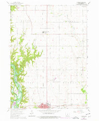
1965 Map of Luther
USGS Topo · Published 1977About this map
Saylorville Lake Des Moines River dominates the southwestern quadrant of this mid-1960s survey, illustrating a landscape defined by significant hydrological management. The valley of the Des Moines River is flanked by steep, dissected terrain near Ledges State Park and the State 4-H Camp, while the surrounding uplands maintain a grid of agricultural section lines. This rural character is anchored by the small community of Luther and the northern edge of Madrid. The industrial and transport history of the region is evidenced by the Chicago Milwaukee St Paul and Pacific Railroad and a Gravel Pit near Caton Branch. Local genealogy is well-supported by numerous burial grounds including Fairview Cem, Rose Hill Cem, and Hillsdale Cem, often located near crossroads or watercourses like Big Creek.
Find a feature on this map
37 named features on this map. Tap any name to fly to it.
Don’t see what you’re looking for? This feature index may not catch every label — zoom into the map to look around manually.
Map Details
Editions of this 1965 Luther Map
2 editions found
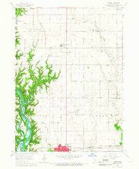
Other maps of this area

1911 · Madrid
USGS Topo · 1:62,500

1911 · Slater
USGS Topo · 1:62,500

1912 · Ames
USGS Topo · 1:62,500

1913 · Slater
USGS Topo · 1:62,500

1914 · Madrid
USGS Topo · 1:62,500

1914 · Ames
USGS Topo · 1:62,500

1916 · Boone
USGS Topo · 1:62,500

1954 · Waterloo
USGS Topo · 1:250,000

1954 · Des Moines
USGS Topo · 1:250,000

1955 · Waterloo
USGS Topo · 1:250,000