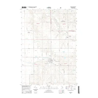
2014 Map of Luther
USGS Topo · Published 2014About this map
Luther serves as the central hub of this Lake County landscape, where the street grid of the village meets the eastern edge of the Manistee National Forest. The geography is defined by a dense network of water bodies and tributaries, including the winding Little Manistee River and the Pine River, which flows past the settlement of Skookum. These waterways, along with Ahmikwam Lake and Rockwell Lake, indicate a region historically shaped by its riparian systems and forest resources. Local heritage is preserved in several burial grounds, such as Pleasant Hill Cem near the town center and North Park Cem to the north. Transportation and utility are represented by the Guy Vander Jagt Airfield and the Skookum Bridge, while the sectional boundaries of t19n r12w and adjacent townships provide a clear look at the public land survey system in this part of Michigan.
Find a feature on this map
85 named features on this map. Tap any name to fly to it.
Don’t see what you’re looking for? This feature index may not catch every label — zoom into the map to look around manually.
Map Details
Editions of this 2014 Luther Map
This is the sole edition of this map. No revisions or reprints were ever made.
Other maps of this area

1931 · Chase NE
USGS Topo · 1:31,680

1931 · Baldwin NE
USGS Topo · 1:31,680

1932 · Chase NW
USGS Topo · 1:31,680

1933 · Peacock SE
USGS Topo · 1:31,680

1933 · Luther SE
USGS Topo · 1:31,680

1933 · Peacock NE
USGS Topo · 1:31,680

1933 · Luther SW
USGS Topo · 1:31,680

1933 · Luther NW
USGS Topo · 1:31,680

1954 · Traverse City
USGS Topo · 1:250,000

1954 · Midland
USGS Topo · 1:250,000