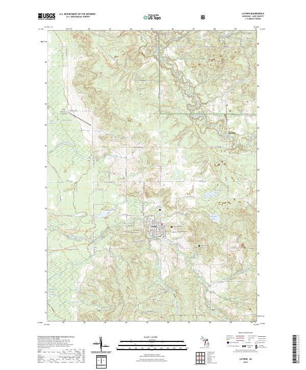
2023 Map of Luther
USGS Topo · Published 2023About this map
Luther serves as the central hub of this Lake County landscape, where the grid of village streets meets the winding course of Little Manistee River. The surrounding terrain within the Manistee National Forest is defined by a dense network of water systems, including Lincoln Creek, Pine River, and the expansive Luther Swamp. To the north, the small settlement of Skookum sits near the edge of Sellers Creek, highlighting the area's history of small-scale rural development. Genealogy researchers can find several localized burial sites, such as North Park Cem and Pleasant Hill Cem, located just outside the main village. The presence of Ahmikwam Lake and Big Spring Lake suggests a landscape shaped by glacial activity, while modern recreational use is evidenced by the Lincoln Hills Motorcycle Trl cutting through the northern timberlands.
Find a feature on this map
82 named features on this map. Tap any name to fly to it.
Don’t see what you’re looking for? This feature index may not catch every label — zoom into the map to look around manually.
Map Details
Editions of this 2023 Luther Map
This is the sole edition of this map. No revisions or reprints were ever made.
Other maps of this area

1931 · Chase NE
USGS Topo · 1:31,680

1931 · Baldwin NE
USGS Topo · 1:31,680

1932 · Chase NW
USGS Topo · 1:31,680

1933 · Peacock SE
USGS Topo · 1:31,680

1933 · Luther SE
USGS Topo · 1:31,680

1933 · Peacock NE
USGS Topo · 1:31,680

1933 · Luther SW
USGS Topo · 1:31,680

1933 · Luther NW
USGS Topo · 1:31,680

1954 · Traverse City
USGS Topo · 1:250,000

1954 · Midland
USGS Topo · 1:250,000