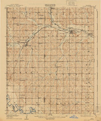
1909 Map of Luther
USGS Topo · Published 1940About this map
Luther and Wellston anchor this early twentieth-century survey of Central Oklahoma, where the landscape is defined by the converging paths of the St. Louis and San Francisco RR and the Missouri Kansas and Texas RR. The map captures a high density of rural institutions from the era, including numerous one-room schoolhouses like Arbuckle School and Sunflower School, alongside cultural landmarks such as the German Church and St Lukes Church.
Find a feature on this map
70 named features on this map. Tap any name to fly to it.
Don’t see what you’re looking for? This feature index may not catch every label — zoom into the map to look around manually.
Map Details
Editions of this 1909 Luther Map
2 editions found
Other maps of this area

1892 · Moore
USGS Topo · 1:62,500

1892 · Guthrie
USGS Topo · 1:62,500

1892 · Edmond
USGS Topo · 1:62,500

1896 · Seminole and Prague
USGS Topo · 1:125,000

1898 · Purcell
USGS Topo · 1:125,000

1905 · Chandler
USGS Topo · 1:62,500

1907 · Chandler
USGS Topo · 1:62,500

1908 · Agra
USGS Topo · 1:62,500

1909 · Shawnee
USGS Topo · 1:62,500

1909 · Luther
USGS Topo · 1:62,500