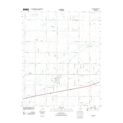
2012 Map of Luther
USGS Topo · Published 2012About this map
Luther serves as the primary hub of this Oklahoma landscape, situated where the Deep Fork river and several key tributaries, including Wildhorse Cr and Smith Cr, converge. The area reflects a established energy economy, defined by the Luther Gas and Oil Field and the South Garden Oil and Gas Field. These industrial sites are interspersed with rural residential developments like Rustic Acres and historical landmarks such as the Bost Ranch Airport.
Find a feature on this map
83 named features on this map. Tap any name to fly to it.
Don’t see what you’re looking for? This feature index may not catch every label — zoom into the map to look around manually.
Map Details
Editions of this 2012 Luther Map
This is the sole edition of this map. No revisions or reprints were ever made.
Other maps of this area

1892 · Guthrie
USGS Topo · 1:62,500

1892 · Edmond
USGS Topo · 1:62,500

1909 · Luther
USGS Topo · 1:62,500

1909 · Perkins
USGS Topo · 1:62,500

1935 · Edmond
USGS Topo · 1:48,000

1940 · Edmond
USGS Topo · 1:62,500

1954 · Oklahoma City
USGS Topo · 1:250,000
1955 · Jones
USGS Topo · 1:24,000

1956 · Horseshoe Lake
USGS Topo · 1:24,000

1957 · Oklahoma City
USGS Topo · 1:250,000