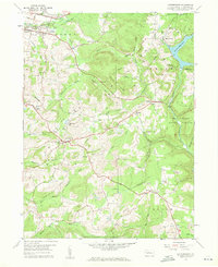
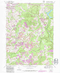
1959 Map of Luthersburg
USGS Topo · Published 1960About this map
The Baltimore And Ohio railroad carves a significant path through this part of Clearfield County, connecting coal-producing highlands with the industrial centers of the late 1950s. The landscape is defined by the high ground of Luthersburg Ridge and Coal Hill, where numerous Strip Mines and a Quarry indicate the area's heavy reliance on mineral extraction. Settlement patterns center on traditional crossroads like Luthersburg, which sits at a convergence of early regional routes, and smaller hamlets such as Rockton and Chestnut Grove.
Find a feature on this map
56 named features on this map. Tap any name to fly to it.
Don’t see what you’re looking for? This feature index may not catch every label — zoom into the map to look around manually.
Map Details
Editions of this 1959 Luthersburg Map
5 editions found
Other maps of this area

1903 · Curwensville
USGS Topo · 1:62,500

1906 · Punxsutawney
USGS Topo · 1:62,500

1922 · Du Bois
USGS Topo · 1:62,500

1924 · Du Bois
USGS Topo · 1:62,500

1929 · Penfield
USGS Topo · 1:62,500

1932 · Penfield
USGS Topo · 1:62,500

1939 · Curwensville
USGS Topo · 1:62,500

1939 · Punxsutawney
USGS Topo · 1:62,500

1942 · Curwensville
USGS Topo · 1:62,500

1942 · Punxsutawney
USGS Topo · 1:62,500