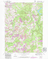
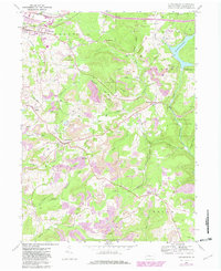
1959 Map of Luthersburg
USGS Topo · Published 1986About this map
The Baltimore and Ohio Railroad defines the industrial and transit corridor through this section of Clearfield County, serving the prominent settlements of Luthersburg and Rockton. These communities, alongside smaller locales like Home Camp and Oklahoma, are anchored by local landmarks such as St Johns Ch and St Peters Ch. The landscape is a complex mix of heavy industry and conservation, with numerous Gas Wells and Strip Mine operations situated near the extensive Moshannon State Forest and State Game Lands No 93. This 1959 survey, later updated in the 1980s, captures the region's reliance on both the railroad and local extraction. Significant infrastructure including the Du Bois Reservoir and the Luthersburg Sta illustrate the logistical importance of the area, while the presence of Morningside Cemetery and several remote Cem locations offer valuable data for genealogical research.
Find a feature on this map
59 named features on this map. Tap any name to fly to it.
Don’t see what you’re looking for? This feature index may not catch every label — zoom into the map to look around manually.
Map Details
Editions of this 1959 Luthersburg Map
5 editions found
Other maps of this area

1903 · Curwensville
USGS Topo · 1:62,500

1906 · Punxsutawney
USGS Topo · 1:62,500

1922 · Du Bois
USGS Topo · 1:62,500

1924 · Du Bois
USGS Topo · 1:62,500

1929 · Penfield
USGS Topo · 1:62,500

1932 · Penfield
USGS Topo · 1:62,500

1939 · Curwensville
USGS Topo · 1:62,500

1939 · Punxsutawney
USGS Topo · 1:62,500

1942 · Curwensville
USGS Topo · 1:62,500

1942 · Punxsutawney
USGS Topo · 1:62,500