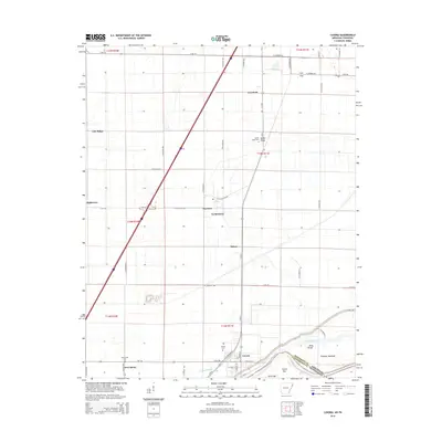
2014 Map of Luxora
USGS Topo · Published 2014About this map
The town of Luxora anchors this Mississippi River delta landscape, situated just north of the winding channel that defines the border between Arkansas and Tennessee. This 2014 survey documents a region defined by extensive drainage networks like Mill Bayou and Catalpa Bayou, essential for the agricultural economy of Mississippi County. Small, established settlements such as Burdette, Lemsford, and New Salem are scattered across the alluvial plain, connected by a grid of rural routes including E Ar-148 and US Highway 61. Genealogists will find several burial sites preserved here, including New Salem Cem, Citizen Cem, and Sandy Ridge Cem. The map captures the industrial and natural intersection of the riverfront, featuring landmarks like Fletcher Towhead and the Levee Road, alongside the shifting shoreline at Rosa Pocket.
Find a feature on this map
43 named features on this map. Tap any name to fly to it.
Don’t see what you’re looking for? This feature index may not catch every label — zoom into the map to look around manually.
Map Details
Editions of this 2014 Luxora Map
This is the sole edition of this map. No revisions or reprints were ever made.
Other maps of this area

1939 · Blytheville
USGS Topo · 1:62,500

1939 · Evadale
USGS Topo · 1:62,500

1941 · Manila
USGS Topo · 1:62,500

1953 · Memphis
USGS Topo · 1:250,000

1955 · Blytheville
USGS Topo · 1:62,500

1956 · Manila
USGS Topo · 1:62,500

1956 · Evadale
USGS Topo · 1:62,500

1956 · Memphis
USGS Topo · 1:250,000

1956 · Blytheville
USGS Topo · 1:250,000

1959 · Blytheville
USGS Topo · 1:250,000