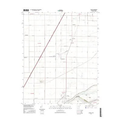
2017 Map of Luxora
USGS Topo · Published 2017About this map
Luxora and the surrounding Mississippi River lowlands are defined by a grid of agricultural roads and the proximity of the Mississippi County and Arkansas-Tennessee border. The landscape is dotted with small communities such as Burdette, Tuckertown, and Lemsford, reflecting a pattern of rural settlement shaped by the fertile bottomlands. Along the river's edge, distinctive fluvial features like Elmot Bar, Fletcher Towhead, and the Rosa Pocket highlight the shifting nature of the river's course over time. Local history is anchored by several cemeteries, including New Salem Cem, Citizen Cem, and Sandy Ridge Cem, while the sluggish Catalpa Bayou meanders through the southern portion of the quadrangle. This area serves as a primary transit corridor where the interstate intersects with local routes like State Hwy 120 and W Plantation Rd.
Find a feature on this map
42 named features on this map. Tap any name to fly to it.
Don’t see what you’re looking for? This feature index may not catch every label — zoom into the map to look around manually.
Map Details
Editions of this 2017 Luxora Map
This is the sole edition of this map. No revisions or reprints were ever made.
Other maps of this area

1939 · Blytheville
USGS Topo · 1:62,500

1939 · Evadale
USGS Topo · 1:62,500

1941 · Manila
USGS Topo · 1:62,500

1953 · Memphis
USGS Topo · 1:250,000

1955 · Blytheville
USGS Topo · 1:62,500

1956 · Manila
USGS Topo · 1:62,500

1956 · Evadale
USGS Topo · 1:62,500

1956 · Memphis
USGS Topo · 1:250,000

1956 · Blytheville
USGS Topo · 1:250,000

1959 · Blytheville
USGS Topo · 1:250,000