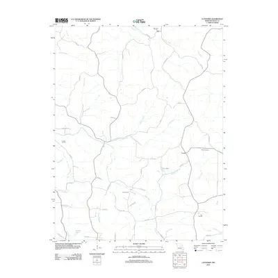
2012 Map of Luystown
USGS Topo · Published 2012About this map
Deer and Crook anchor this portion of Osage County, where a complex network of county roads and branches defines the Missouri landscape. The area is marked by a significant number of family and community burial grounds, including the Deer Creek Cemetery in the north and the Agee Cemetery further south, providing a clear map for genealogical research. Waterways like Luystown Creek, Deer Creek, and Indian Creek carve through the terrain, accompanied by smaller features such as Lake Acres and Franken Lake. The road system, from Co HWY-319 to the more localized Hoelscher Trl, reflects the rural agricultural character of the region in the early 21st century. This survey documents the persistent placement of rural landmarks and homestead access points like Old Flora Ln and Bree Zee Ln.
Find a feature on this map
50 named features on this map. Tap any name to fly to it.
Don’t see what you’re looking for? This feature index may not catch every label — zoom into the map to look around manually.
Map Details
Editions of this 2012 Luystown Map
This is the sole edition of this map. No revisions or reprints were ever made.
Other maps of this area

1890 · Fulton
USGS Topo · 1:125,000

1934 · Linn
USGS Topo · 1:48,000

1934 · Bland
USGS Topo · 1:62,500

1935 · Morrison
USGS Topo · 1:48,000

1937 · Bland
USGS Topo · 1:62,500

1942 · Linn
USGS Topo · 1:62,500

1942 · Morrison
USGS Topo · 1:62,500

1945 · Mokane
USGS Topo · 1:62,500

1945 · Morrison
USGS Topo · 1:62,500

1945 · Linn
USGS Topo · 1:62,500