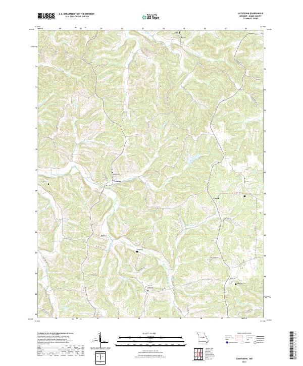
2021 Map of Luystown
USGS Topo · Published 2021About this map
Luystown serves as the focal point of this Osage County landscape, where the confluence of several waterways shaped the early road network. The settlement is positioned along Luystown Cr, which is fed by Ben Br and Ben Branch as it flows toward the surrounding hills. This area is notably dense with small family and community burial grounds, providing a significant resource for genealogical research. Documented sites include Deer Creek Cem, Laughlin Cem, and the Fairview Church of Christ Cem.
Find a feature on this map
70 named features on this map. Tap any name to fly to it.
Don’t see what you’re looking for? This feature index may not catch every label — zoom into the map to look around manually.
Map Details
Editions of this 2021 Luystown Map
This is the sole edition of this map. No revisions or reprints were ever made.
Other maps of this area

1890 · Fulton
USGS Topo · 1:125,000

1934 · Linn
USGS Topo · 1:48,000

1934 · Bland
USGS Topo · 1:62,500

1935 · Morrison
USGS Topo · 1:48,000

1937 · Bland
USGS Topo · 1:62,500

1942 · Linn
USGS Topo · 1:62,500

1942 · Morrison
USGS Topo · 1:62,500

1945 · Mokane
USGS Topo · 1:62,500

1945 · Morrison
USGS Topo · 1:62,500

1945 · Linn
USGS Topo · 1:62,500