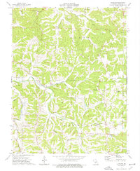
1975 Map of Luystown
USGS Topo · Published 1977About this map
Luystown serves as the central settlement in this mid-1970s topographic study of Osage County, where the landscape is defined by the sharp divides of Benton, Linn, and Crawford townships. The map documents a rural economy tied to the land, evidenced by several Claypits and an extensive Pipeline corridor cutting across the southern terrain. Waterways like Cedar Creek and its many tributaries, including Trussell Creek and Ben Branch, carve deep valleys through the region, influencing the placement of early infrastructure.
Find a feature on this map
28 named features on this map. Tap any name to fly to it.
Don’t see what you’re looking for? This feature index may not catch every label — zoom into the map to look around manually.
Map Details
Editions of this 1975 Luystown Map
This is the sole edition of this map. No revisions or reprints were ever made.
Other maps of this area

1890 · Fulton
USGS Topo · 1:125,000

1934 · Linn
USGS Topo · 1:48,000

1934 · Bland
USGS Topo · 1:62,500

1935 · Morrison
USGS Topo · 1:48,000

1937 · Bland
USGS Topo · 1:62,500

1942 · Linn
USGS Topo · 1:62,500

1942 · Morrison
USGS Topo · 1:62,500

1945 · Mokane
USGS Topo · 1:62,500

1945 · Morrison
USGS Topo · 1:62,500

1945 · Linn
USGS Topo · 1:62,500