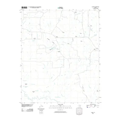
2010 Map of Lydia
USGS Topo · Published 2010About this map
Lydia serves as a small focal point in this northeast Texas landscape, situated north of the meandering Sulphur River. The area is characterized by low-lying wetlands and prairies, including Shawnee Prairie and Walkers Prairie, which are interlaced with numerous water bodies like Grassy Lake, Long Lake, and Hardison Lake. A dense network of family and community cemeteries, such as Rehobeth Cemetery, Walker Cemetery, and Baker Cemetery, reflects a long-established rural population. Transportation is facilitated by FM 44 and several county roads that connect isolated farmsteads. Distinctive landmarks like Hardison Mound and the Keys Ranch Airport offer points of interest for those studying the land use and historical geography of this river basin region.
Find a feature on this map
49 named features on this map. Tap any name to fly to it.
Don’t see what you’re looking for? This feature index may not catch every label — zoom into the map to look around manually.
Map Details
Editions of this 2010 Lydia Map
This is the sole edition of this map. No revisions or reprints were ever made.
Other maps of this area

1930 · Bassett
USGS Topo · 1:62,500

1950 · Oak Grove
USGS Topo · 1:24,000

1950 · Annona
USGS Topo · 1:24,000

1951 · Annona
USGS Topo · 1:24,000

1951 · Oak Grove
USGS Topo · 1:24,000

1951 · Avery
USGS Topo · 1:24,000

1953 · Texarkana
USGS Topo · 1:250,000

1956 · Texarkana
USGS Topo · 1:250,000

1964 · Wilkinson
USGS Topo · 1:24,000

1965 · Lydia
USGS Topo · 1:24,000