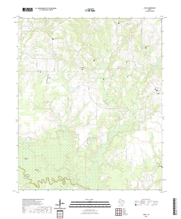
2022 Map of Lydia
USGS Topo · Published 2022About this map
Lydia serves as the quiet anchor of this northeastern Texas landscape, situated just north of the Sulphur River along the boundary of Red River Co and Titus Co. The terrain is characterized by broad expanses like Shawnee Prairie and Walkers Prairie, which are defined by a complex drainage system of creeks including Shawnee Cr, Dillard Cr, and Caney Cr. The density of family and community burial sites, such as Shawnee Cem, Wooten Cem, and Rehobeth Cem, suggests a long-established rural settlement pattern tied to the land's natural contours. Near the river, the environment shifts to bottomlands marked by Grassy Lake, Hardison Lake, and Cutoff Slough. Notable landmarks like Hardison Mound and Whiteoak Knoll rise above the wetlands, while the Molair Airport indicates a layer of modern utility in this traditionally agricultural area.
Find a feature on this map
59 named features on this map. Tap any name to fly to it.
Don’t see what you’re looking for? This feature index may not catch every label — zoom into the map to look around manually.
Map Details
Editions of this 2022 Lydia Map
This is the sole edition of this map. No revisions or reprints were ever made.
Other maps of this area

1930 · Bassett
USGS Topo · 1:62,500

1950 · Oak Grove
USGS Topo · 1:24,000

1950 · Annona
USGS Topo · 1:24,000

1951 · Annona
USGS Topo · 1:24,000

1951 · Oak Grove
USGS Topo · 1:24,000

1951 · Avery
USGS Topo · 1:24,000

1953 · Texarkana
USGS Topo · 1:250,000

1956 · Texarkana
USGS Topo · 1:250,000

1964 · Wilkinson
USGS Topo · 1:24,000

1965 · Lydia
USGS Topo · 1:24,000