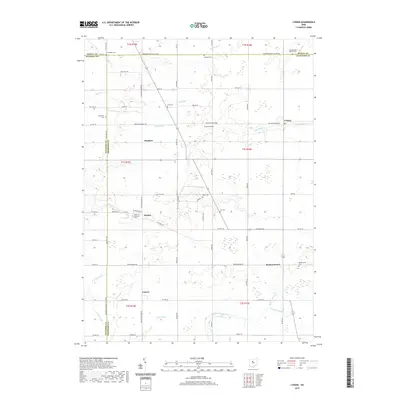
2019 Map of Lykens
USGS Topo · Published 2019About this map
Lykens and surrounding rural hamlets are situated within the productive agricultural lands of Crawford County, marking a landscape defined by century-old township grids and small family burial grounds. The area is intersected by numerous watercourses, including Sycamore Creek and Broken Sword Creek, which drain the level terrain. Local history and genealogy researchers will find significant value in the distribution of small community cemeteries like Texas Township Cem, Pipetown Cem, and Eden Cem, which often represent the earliest established points of settlement in this part of Ohio. The proximity of Plankton and Benton highlights the traditional road network that connects these farm communities, while Broken Sword and Lemert sit further south along winding creeks. This 2019 survey documents the enduring settlement patterns of these townships, where long-established section lines and farm-to-market roads continue to shape the local geography.
Find a feature on this map
78 named features on this map. Tap any name to fly to it.
Don’t see what you’re looking for? This feature index may not catch every label — zoom into the map to look around manually.
Map Details
Editions of this 2019 Lykens Map
This is the sole edition of this map. No revisions or reprints were ever made.
Other maps of this area

1906 · Sycamore
USGS Topo · 1:62,500

1906 · Tiffin
USGS Topo · 1:62,500

1915 · Siam
USGS Topo · 1:62,500

1915 · Bucyrus
USGS Topo · 1:62,500

1943 · Bucyrus
USGS Topo · 1:62,500

1950 · Marion
USGS Topo · 1:250,000

1956 · Toledo
USGS Topo · 1:250,000

1960 · Sycamore
USGS Topo · 1:24,000

1960 · Tiffin South
USGS Topo · 1:24,000

1960 · Oceola
USGS Topo · 1:24,000