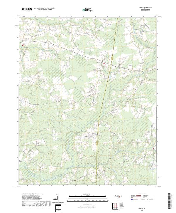
2022 Map of Lyman
USGS Topo · Published 2022About this map
Fountain and Lyman anchor this corner of the Coastal Plain where the border between Duplin and Onslow counties meets. The landscape is defined by its drainage patterns, with the wide reaches of Back Swamp and Big Br cutting through the terrain. Human settlement follows the high ground and established road networks, such as Cedar Fork Rd and Cypress Creek Rd, which connect small communities like Cedar Fork and Cypress Creek.
Find a feature on this map
56 named features on this map. Tap any name to fly to it.
Don’t see what you’re looking for? This feature index may not catch every label — zoom into the map to look around manually.
Map Details
Editions of this 2022 Lyman Map
This is the sole edition of this map. No revisions or reprints were ever made.
Other maps of this area

1942 · Burgaw
USGS Topo · 1:62,500

1943 · Kenansville
USGS Topo · 1:62,500

1948 · Kenansville
USGS Topo · 1:62,500

1948 · Maple Hill
USGS Topo · 1:62,500

1948 · Richlands
USGS Topo · 1:62,500

1953 · Beaufort
USGS Topo · 1:250,000

1954 · Beaufort
USGS Topo · 1:250,000

1965 · Richlands
USGS Topo · 1:62,500

1972 · Beaufort
USGS Topo · 1:250,000
1980 · Richlands
USGS Topo · 1:62,500