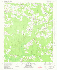
1981 Map of Lyman
USGS Topo · Published 1981About this map
Lyman and the surrounding coastal plain of Duplin County are defined by a network of slow-moving waters and rural communities in the early 1980s. The landscape is characterized by the expansive Back Swamp and Tenmile Swamp, where the terrain creates a mosaic of timberland and small family farms. Local life is centered around rural crossroads and spiritual landmarks like Old Bethlehem Ch, Cedar Fork Ch, and Bethany Ch. Transportation and commerce are reflected in the presence of Fountain Airport and a nearby landing strip, while small settlements such as Browning, James, and Fountain dot the secondary roads. The map also captures the transition across the Duplin and Onslow county line, documenting numerous family cemeteries and local water bodies like Lee Baysden Pond that were integral to the area's agricultural identity.
Find a feature on this map
34 named features on this map. Tap any name to fly to it.
Don’t see what you’re looking for? This feature index may not catch every label — zoom into the map to look around manually.
Map Details
Editions of this 1981 Lyman Map
This is the sole edition of this map. No revisions or reprints were ever made.
Other maps of this area

1942 · Burgaw
USGS Topo · 1:62,500

1943 · Kenansville
USGS Topo · 1:62,500

1948 · Kenansville
USGS Topo · 1:62,500

1948 · Maple Hill
USGS Topo · 1:62,500

1948 · Richlands
USGS Topo · 1:62,500

1953 · Beaufort
USGS Topo · 1:250,000

1954 · Beaufort
USGS Topo · 1:250,000

1965 · Richlands
USGS Topo · 1:62,500

1972 · Beaufort
USGS Topo · 1:250,000
1980 · Richlands
USGS Topo · 1:62,500