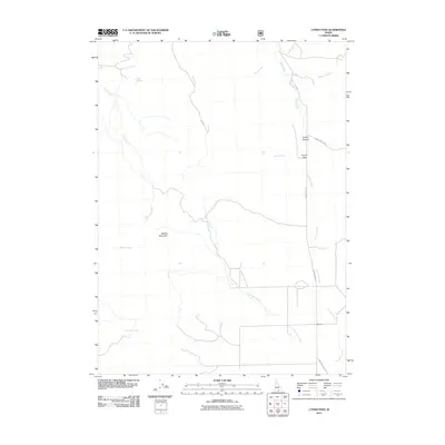
2011 Map of Lyman Pass
USGS Topo · Published 2011About this map
Middle Mountain dominates the western half of this 2011 survey, overlooking a drainage network that defines the landscape of southern Idaho. The small settlement of Moulton sits in the southeastern corner near the confluence of several seasonal and perennial flows, including Cottonwood Creek and Junction Creek. This area illustrates a typical high-desert ranching and grazing environment, where access is dictated by primitive routes like Birch Creek Rd and Emery Canyon Rd. The passage at Lyman Pass provides a natural corridor through the terrain, connecting the higher elevations with the valley floors. Water sources are critical in this landscape, marked by named features such as Slide Spring and Blue Hill Creek, which would have been vital points for early settlers and livestock. The map captures the interface between the elevated mountain slopes and the drainages that supported the local cattle industry.
Find a feature on this map
17 named features on this map. Tap any name to fly to it.
Don’t see what you’re looking for? This feature index may not catch every label — zoom into the map to look around manually.
Map Details
Editions of this 2011 Lyman Pass Map
This is the sole edition of this map. No revisions or reprints were ever made.
Other maps of this area

1954 · Pocatello
USGS Topo · 1:250,000

1954 · Brigham City
USGS Topo · 1:250,000

1958 · Pocatello
USGS Topo · 1:250,000

1958 · Brigham City
USGS Topo · 1:250,000

1959 · Cotton Thomas Basin
USGS Topo · 1:62,500

1959 · Yost
USGS Topo · 1:62,500

1962 · Brigham City
USGS Topo · 1:250,000

1968 · Almo
USGS Topo · 1:24,000

1968 · Cache Peak
USGS Topo · 1:24,000

1968 · Basin
USGS Topo · 1:24,000