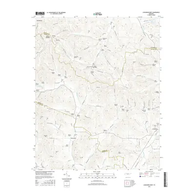
2016 Map of Lynchburg West
USGS Topo · Published 2016About this map
Booneville and the western outskirts of Lynchburg anchor this Tennessee landscape, where the borders of Bedford, Moore, and Lincoln Counties converge. The terrain is defined by a dense network of hollows, such as Sam Hart Hollow and Possumtrot Hollow, which dictate the winding paths of rural routes like Bobby Dodd Mix Rd. The area is notably dense with family and community burial grounds, reflecting generations of local settlement. Genealogists can find the Lynchburg City Cem and the Highview Cem near the town center, while more remote sites like the Pearson Cem and Womack Cem are tucked into the hills. Water sources like W Fork Mulberry Cr and Coleman Fork flow through the valleys, supporting the small communities of Mount Herman and New Herman as they have for decades.
Find a feature on this map
143 named features on this map. Tap any name to fly to it.
Don’t see what you’re looking for? This feature index may not catch every label — zoom into the map to look around manually.
Map Details
Editions of this 2016 Lynchburg West Map
This is the sole edition of this map. No revisions or reprints were ever made.
Other maps of this area

1936 · Booneville
USGS Topo · 1:24,000

1936 · Shelbyville
USGS Topo · 1:24,000

1936 · Cumberland Springs
USGS Topo · 1:24,000

1936 · Belleville
USGS Topo · 1:24,000

1936 · Bedford
USGS Topo · 1:24,000

1936 · Mulberry
USGS Topo · 1:24,000

1936 · Normandy
USGS Topo · 1:24,000

1936 · Fayetteville
USGS Topo · 1:24,000

1936 · Lois
USGS Topo · 1:24,000

1941 · Cumberland Springs
USGS Topo · 1:24,000