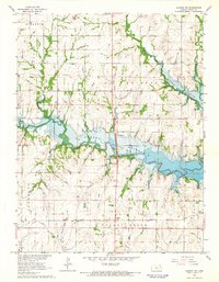
1965 Map of Lyndon NW
USGS Topo · Published 1966About this map
The Old Indian Treaty Boundary cuts a diagonal path across this Osage County landscape, a permanent mark of nineteenth-century land divisions amidst a mid-twentieth-century transformation. The filling of the Pomona Reservoir dominates the central topography, where the waters of Dragoon Creek and Hundred and Ten Mile Creek meet. This era of infrastructure development is further evidenced by Carbolyn State Park and the nearby Roadside Park, which provided new recreational spaces as the reservoir reshaped the valley.
Find a feature on this map
21 named features on this map. Tap any name to fly to it.
Don’t see what you’re looking for? This feature index may not catch every label — zoom into the map to look around manually.
Map Details
Editions of this 1965 Lyndon NW Map
2 editions found
Other maps of this area

1889 · Burlingame
USGS Topo · 1:125,000

1894 · Burlingame
USGS Topo · 1:125,000

1947 · Lawrence
USGS Topo · 1:250,000

1950 · Lawrence
USGS Topo · 1:250,000

1952 · Burlingame
USGS Topo · 1:24,000

1955 · Overbrook
USGS Topo · 1:24,000

1955 · Carbondale
USGS Topo · 1:24,000

1956 · Lawrence
USGS Topo · 1:250,000

1961 · Lawrence
USGS Topo · 1:250,000
1965 · Lyndon
USGS Topo · 1:24,000