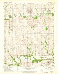
1965 Map of Lyndon
USGS Topo · Published 1966About this map
Lyndon serves as the focal point of this mid-1960s Osage County landscape, characterized by its grid layout and local institutions like the Hilltop Nursing Home. To the southeast, the town of Melvern is positioned along the banks of the Marais des Cygnes River, a major waterway winding through the southern portion of the quadrangle. The map reveals a transition in transportation infrastructure, showing the active Atchison Topeka and Santa Fe railroad line passing through the south, while an Old Railroad Grade follows the course of Salt Creek further north. This shift from older rail alignments to modern development is reflected in the landscape's utility features, such as the Sewage Disposal plant and the municipal Reservoir near Lyndon. Smaller rural landmarks, including the Mt Pleasant Ch and family-linked burial sites like Dane Cem, provide valuable geographic markers for genealogical research.
Find a feature on this map
27 named features on this map. Tap any name to fly to it.
Don’t see what you’re looking for? This feature index may not catch every label — zoom into the map to look around manually.
Map Details
Editions of this 1965 Lyndon Map
3 editions found
Other maps of this area

1885 · Burlington
USGS Topo · 1:125,000

1889 · Burlingame
USGS Topo · 1:125,000

1894 · Burlingame
USGS Topo · 1:125,000

1894 · Burlington
USGS Topo · 1:125,000

1947 · Lawrence
USGS Topo · 1:250,000

1950 · Lawrence
USGS Topo · 1:250,000

1956 · Lawrence
USGS Topo · 1:250,000

1957 · Lebo
USGS Topo · 1:24,000

1957 · Waverly NW
USGS Topo · 1:24,000

1957 · Waverly
USGS Topo · 1:24,000