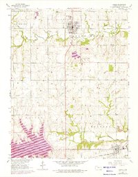
1965 Map of Lyndon
USGS Topo · Published 1976About this map
The town of Lyndon serves as the focal point of this Osage County landscape, which underwent significant change during the mid-1960s and early 1970s. The southern portion of the map is dominated by the newly formed Melvern Lake, a major reservoir project along the Marais des Cygnes River with a recorded normal pool elevation of 1036. This shift from riverine bottomlands to lakefront is contrasted by the established agricultural character of Superior and Valley Brook townships.
Find a feature on this map
29 named features on this map. Tap any name to fly to it.
Don’t see what you’re looking for? This feature index may not catch every label — zoom into the map to look around manually.
Map Details
Editions of this 1965 Lyndon Map
3 editions found
Other maps of this area

1885 · Burlington
USGS Topo · 1:125,000

1889 · Burlingame
USGS Topo · 1:125,000

1894 · Burlingame
USGS Topo · 1:125,000

1894 · Burlington
USGS Topo · 1:125,000

1947 · Lawrence
USGS Topo · 1:250,000

1950 · Lawrence
USGS Topo · 1:250,000

1956 · Lawrence
USGS Topo · 1:250,000

1957 · Lebo
USGS Topo · 1:24,000

1957 · Waverly NW
USGS Topo · 1:24,000

1957 · Waverly
USGS Topo · 1:24,000