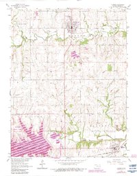
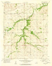
1965 Map of Lyndon
USGS Topo · Published 1983About this map
Lyndon stands as a central hub in Osage County, its residential grid defined by the Hilltop Nursing Home and proximity to Salt Creek. The landscape transition in this mid-century period is marked by the presence of Melvern Lake, a significant reservoir that reshaped the southern portion of the quadrangle. Surrounding the water, specialized zones like the Melvern State Park and the Coeur d'Alene Recreation Area indicate the shift toward recreation in the valley.
Find a feature on this map
29 named features on this map. Tap any name to fly to it.
Don’t see what you’re looking for? This feature index may not catch every label — zoom into the map to look around manually.
Map Details
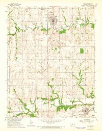
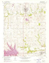
Editions of this 1965 Lyndon Map
3 editions found
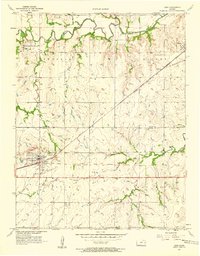
Other maps of this area

1885 · Burlington
USGS Topo · 1:125,000

1889 · Burlingame
USGS Topo · 1:125,000

1894 · Burlingame
USGS Topo · 1:125,000

1894 · Burlington
USGS Topo · 1:125,000

1947 · Lawrence
USGS Topo · 1:250,000

1950 · Lawrence
USGS Topo · 1:250,000

1956 · Lawrence
USGS Topo · 1:250,000
1957 · Lebo
USGS Topo · 1:24,000
1957 · Waverly NW
USGS Topo · 1:24,000
1957 · Waverly
USGS Topo · 1:24,000