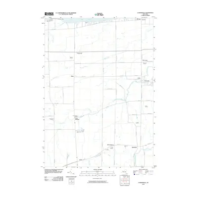
2010 Map of Lyndonville
USGS Topo · Published 2010About this map
Thirtymile Point Light stands as a sentinel on the shores of Lake Ontario, marking the northern edge of a landscape defined by its agricultural heritage. In the village of Lyndonville, the concentration of residential streets around Johnson Creek and the Lyndonville Water Works illustrates the historic core of this Orleans County community. The surrounding countryside reflects a pattern of large-scale farming, with notable operations such as Empire Orchards, Bashford's Farm, and the Al-Lin Fruit Farm highlighting the region's long-standing fruit-growing economy. Genealogists will find a wealth of local history preserved in numerous burial grounds, including the Lynhaven Cemetery and Saint Patricks Cemetery. From the crossroads of Ridgeway to the smaller hamlets of Jeddo and Millers, the map documents a stable rural geography where early settlement sites and family-run farms remain central to the local identity.
Find a feature on this map
61 named features on this map. Tap any name to fly to it.
Don’t see what you’re looking for? This feature index may not catch every label — zoom into the map to look around manually.
Map Details
Editions of this 2010 Lyndonville Map
This is the sole edition of this map. No revisions or reprints were ever made.
Other maps of this area

1897 · Olcott
USGS Topo · 1:62,500

1897 · Medina
USGS Topo · 1:62,500

1897 · Lockport
USGS Topo · 1:62,500

1897 · Ridgeway
USGS Topo · 1:62,500

1899 · Niagara
USGS Topo · 1:125,000

1902 · Lockport
USGS Topo · 1:62,500

1905 · Lockport
USGS Topo · 1:62,500

1944 · Ashwood
USGS Topo · 1:31,680

1948 · Lockport
USGS Topo · 1:62,500

1948 · Olcott
USGS Topo · 1:62,500