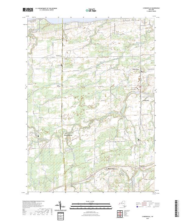
2023 Map of Lyndonville
USGS Topo · Published 2023About this map
Thirtymile Point anchors the northern shoreline of this Orleans County landscape, where the waters of Lake Ontario meet a coastal plain defined by agricultural drainage and early crossroads settlements. The interior is characterized by the branching paths of Johnson Creek and Marsh Creek, which historically supported the milling and farming economies of communities like Millers and Yates Center. These waterways, along with Jeddo Creek, create a distinct drainage pattern that has influenced the placement of roads and homesteads for generations.
Find a feature on this map
44 named features on this map. Tap any name to fly to it.
Don’t see what you’re looking for? This feature index may not catch every label — zoom into the map to look around manually.
Map Details
Editions of this 2023 Lyndonville Map
This is the sole edition of this map. No revisions or reprints were ever made.
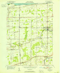
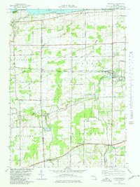
Historical Maps of Jeddo Through Time
3 maps found