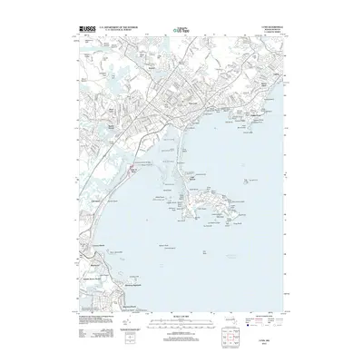
2012 Map of Lynn
USGS Topo · Published 2012About this map
High Rock and Red Rock look out over the intricate coastline of this Massachusetts north shore corridor, where the urban density of East Lynn and West Lynn meets the Atlantic. The landscape is defined by a heavy reliance on coastal infrastructure, seen in the numerous maritime aids such as Sandy Point Light and the Black Marsh Channel Light marking the approaches to Nahant Bay. Further inland, the map captures the transition from residential grids to significant landmarks like the Old East Burying Ground and the sprawling Swampscott Cem.
Find a feature on this map
130 named features on this map. Tap any name to fly to it.
Don’t see what you’re looking for? This feature index may not catch every label — zoom into the map to look around manually.
Map Details
Editions of this 2012 Lynn Map
This is the sole edition of this map. No revisions or reprints were ever made.
Other maps of this area

1886 · Lawrence
USGS Topo · 1:62,500

1888 · Lawrence
USGS Topo · 1:62,500

1888 · Salem
USGS Topo · 1:62,500

1892 · Boston Bay
USGS Topo · 1:62,500

1893 · Salem
USGS Topo · 1:62,500

1893 · Boston
USGS Topo · 1:62,500

1893 · Lawrence
USGS Topo · 1:62,500

1903 · Boston
USGS Topo · 1:62,500

1903 · Boston Bay
USGS Topo · 1:62,500

1917 · Salem
USGS Topo · 1:62,500