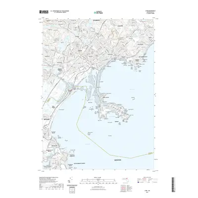
2021 Map of Lynn
USGS Topo · Published 2021About this map
Lynn and its coastal neighbors are defined by a complex interface of rocky headlands and extensive salt marshes along the Massachusetts shore. The urban density of East Lynn and West Lynn is balanced by significant green spaces and historical sites, including the massive Pine Grove Cem and the legendary Dungeon Rock near Dog Hill. To the south, the narrow isthmus of Long Beach connects the mainland to the rocky peninsula of Little Nahant and Nahant, where the terrain terminates at East Point. The landscape reflects a mix of maritime heritage and modern infrastructure, from the tidal reaches of the Saugus River Marshes to the busy northern perimeter of General Edward Lawrence Logan International Airport. Cultural landmarks like North Shore Community College and several historic burial sites, such as the Old East Burying Ground, anchor the community's coastal geography.
Find a feature on this map
294 named features on this map. Tap any name to fly to it.
Don’t see what you’re looking for? This feature index may not catch every label — zoom into the map to look around manually.
Map Details
Editions of this 2021 Lynn Map
This is the sole edition of this map. No revisions or reprints were ever made.
Other maps of this area

1886 · Lawrence
USGS Topo · 1:62,500

1888 · Lawrence
USGS Topo · 1:62,500

1888 · Salem
USGS Topo · 1:62,500

1892 · Boston Bay
USGS Topo · 1:62,500

1893 · Salem
USGS Topo · 1:62,500

1893 · Boston
USGS Topo · 1:62,500

1893 · Lawrence
USGS Topo · 1:62,500

1903 · Boston
USGS Topo · 1:62,500

1903 · Boston Bay
USGS Topo · 1:62,500

1917 · Salem
USGS Topo · 1:62,500