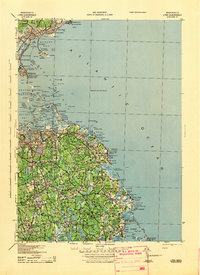
1943 Map of Lynn
USGS Topo · Published 1943About this map
Coastal fortifications and maritime navigation markers dominate the North Shore and South Shore landscapes in this wartime survey by the Army Map Service. Strategic defenses like Fort Warren on Georges Island and Fort Standish on Lovell Island stand guard over the approaches to Boston, while numerous lighthouses including Boston LH and Minots Ledge LH guide vessels through the outer harbor islands. The map details the dense coastal developments of the early 1940s, from the popular sands of Nantasket Beach and Revere Beach to the industrial waterfronts at Quincy and Weymouth. Inland, the terrain is dotted with significant water bodies such as Accord Pond and Silver Lake, which helped sustain the growing communities of Hingham and Rockland during this era of rapid mobilization and regional expansion.
Find a feature on this map
199 named features on this map. Tap any name to fly to it.
Don’t see what you’re looking for? This feature index may not catch every label — zoom into the map to look around manually.
Map Details
Editions of this 1943 Lynn Map
This is the sole edition of this map. No revisions or reprints were ever made.
Other maps of this area

1886 · Lawrence
USGS Topo · 1:62,500

1888 · Lawrence
USGS Topo · 1:62,500

1888 · Salem
USGS Topo · 1:62,500

1892 · Boston Bay
USGS Topo · 1:62,500

1893 · Salem
USGS Topo · 1:62,500

1893 · Boston
USGS Topo · 1:62,500

1893 · Lawrence
USGS Topo · 1:62,500

1903 · Boston
USGS Topo · 1:62,500

1903 · Boston Bay
USGS Topo · 1:62,500

1917 · Salem
USGS Topo · 1:62,500