
2016 Map of Lynn Mountain
USGS Topo · Published 2016About this map
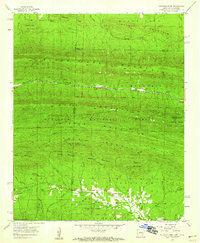
The Kiamichi Mountains dominate the northern landscape of this Oklahoma survey, where steep ridges rise above the deeply incised valleys of the Ouachita National Forest. This terrain is defined by its prominent summits, including Lynn Mtn, Blue Bouncer Mtn, and Phillips Mountain, which provide a natural barrier across the Le Flore and McCurtain county border. The drainage network is particularly dense here, with Pigeon Cr and Cucumber Cr cutting through the highlands before feeding into larger systems to the south.
Find a feature on this map
27 named features on this map. Tap any name to fly to it.
Don’t see what you’re looking for? This feature index may not catch every label — zoom into the map to look around manually.
Map Details
Editions of this 2016 Lynn Mountain Map
This is the sole edition of this map. No revisions or reprints were ever made.
Other maps of this area

1890 · Poteau Mountain
USGS Topo · 1:125,000

1899 · Poteau Mountain
USGS Topo · 1:125,000

1900 · Winding Stair
USGS Topo · 1:125,000

1902 · Lukfata
USGS Topo · 1:125,000

1909 · Winding Stair
USGS Topo · 1:125,000

1913 · De Queen
USGS Topo · 1:125,000

1950 · Mcalester
USGS Topo · 1:250,000

1958 · Potter
USGS Topo · 1:62,500

1958 · Zafra
USGS Topo · 1:24,000
1958 · Mountain Fork
USGS Topo · 1:24,000