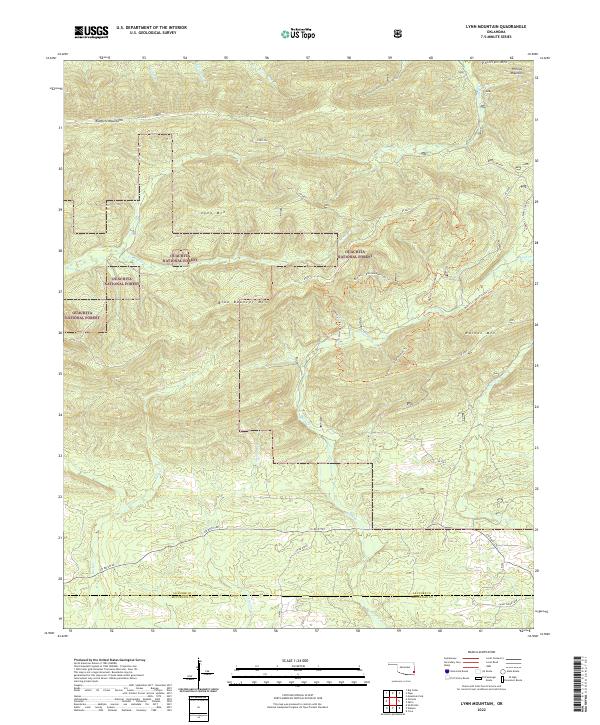
2022 Map of Lynn Mountain
USGS Topo · Published 2022About this map
The Kiamichi Mountains dominate this landscape within the Ouachita National Forest, where a network of ridge-running trails and timber roads defines the local geography. High peaks such as Lynn Mtn and Blue Bouncer Mtn separate deep drainage basins, with numerous creeks like Cucumber Cr and Beech Cr cutting through the terrain. This modern survey illustrates the enduring wilderness character of the border region between Le Flore and McCurtain counties. While the area is largely devoid of traditional town centers, the presence of the Caney Creek Loop and roads like Co RD e1720 indicate the ongoing use of these uplands for recreation and forest management. Researchers will find a detailed look at the hydrology of the headwaters, including Pigeon Cr and Rock Cr, which flow through these protected federal lands.
Find a feature on this map
35 named features on this map. Tap any name to fly to it.
Don’t see what you’re looking for? This feature index may not catch every label — zoom into the map to look around manually.
Map Details
Editions of this 2022 Lynn Mountain Map
This is the sole edition of this map. No revisions or reprints were ever made.
Other maps of this area

1890 · Poteau Mountain
USGS Topo · 1:125,000

1899 · Poteau Mountain
USGS Topo · 1:125,000

1900 · Winding Stair
USGS Topo · 1:125,000

1902 · Lukfata
USGS Topo · 1:125,000

1909 · Winding Stair
USGS Topo · 1:125,000

1913 · De Queen
USGS Topo · 1:125,000

1950 · Mcalester
USGS Topo · 1:250,000

1958 · Potter
USGS Topo · 1:62,500

1958 · Zafra
USGS Topo · 1:24,000
1958 · Mountain Fork
USGS Topo · 1:24,000