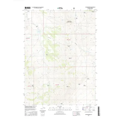
2017 Map of Lynn Reservoir
USGS Topo · Published 2017About this map
Lynn sits at the northern edge of this high-elevation landscape, where the Raft River Mountains and Grouse Creek Mountains converge in Box Elder County. This 2017 survey shows a region defined by complex topography and essential water sources, including the Lynn Reservoir and numerous high-country springs such as Chambers Spring and Thirtysix Spring. The settlement pattern is sparse, centered on the historic Lynn Cem and the grazing lands of Junction Valley. Much of the eastern terrain falls within the Sawtooth National Forest, reaching toward prominent elevations like Marble Canyon Peak. The map provides a contemporary view of the region's rugged geography, tracing drainage systems from Muddy Canyon to the Left Hand Fork Dove Cr, which navigate the steep transition through Dave Creek Pass.
Find a feature on this map
34 named features on this map. Tap any name to fly to it.
Don’t see what you’re looking for? This feature index may not catch every label — zoom into the map to look around manually.
Map Details
Editions of this 2017 Lynn Reservoir Map
This is the sole edition of this map. No revisions or reprints were ever made.
Other maps of this area

1954 · Brigham City
USGS Topo · 1:250,000

1958 · Brigham City
USGS Topo · 1:250,000

1959 · Cotton Thomas Basin
USGS Topo · 1:62,500

1959 · Yost
USGS Topo · 1:62,500

1962 · Brigham City
USGS Topo · 1:250,000

1971 · Potters Creek
USGS Topo · 1:24,000

1971 · Warm Spring Hills
USGS Topo · 1:24,000
1971 · Ingham Canyon
USGS Topo · 1:24,000

1987 · Grouse Creek
USGS Topo · 1:100,000
1990 · Dennis Hill
USGS Topo · 1:24,000