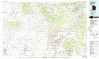
1979 Map of Lynndyl
USGS Topo · Published 1979About this map
Little Sahara National Recreation Area and its expansive Sand Dunes dominate the central landscape of this 1970s survey, illustrating a region defined by arid basins and resource-heavy mountain ranges. The eastern portion of the sheet reveals a dense network of industrial history within the East Tintic Mountains, where numerous operations like the Mammoth Mine, Iron King Mine, and Trixie Mine are clustered around the settlements of Eureka and Mammoth. This concentration of mining activity contrasts sharply with the western desert reaches near Keg Mountain and the Old River Bed.
Find a feature on this map
95 named features on this map. Tap any name to fly to it.
Don’t see what you’re looking for? This feature index may not catch every label — zoom into the map to look around manually.
Map Details
Editions of this 1979 Lynndyl Map
2 editions found

Other maps of this area

1885 · Salt Lake
USGS Topo · 1:250,000

1885 · Manti
USGS Topo · 1:250,000

1885 · Sevier Desert
USGS Topo · 1:250,000

1885 · Tooele Valley
USGS Topo · 1:250,000

1895 · Manti
USGS Topo · 1:250,000

1908 · Fish Springs
USGS Topo · 1:250,000

1910 · Fish Springs
USGS Topo · 1:250,000

1947 · Fivemile Pass
USGS Topo · 1:62,500

1947 · Allens Ranch
USGS Topo · 1:24,000

1947 · Boulter Peak
USGS Topo · 1:24,000