
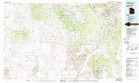
1979 Map of Lynndyl
USGS Topo · Published 1979About this map
Mining settlements and high desert terrain dominate this late 1970s landscape where the West Tintic Mountains and Tintic Mountains meet. The area’s industrial history is well-documented through concentrated operations such as the Erickson Mine, Pyramid Mine, and Sunbeam Mine, clustered near established towns like Eureka, Mammoth, and Silver City. The transportation network is anchored by the Union Pacific railroad, which tracks south through Tintic Valley toward Lynndyl and Leamington, bypassing the expansive Little Sahara National Recreation Area. To the west, the arid expanse of Crater Bench and Keg Mountain reveal a more isolated geography, punctuated by the Old River Bed and the Sevier River. This survey captures the transition from the bustling Tintic mining district to the open basins and dunes of central Utah.
Find a feature on this map
60 named features on this map. Tap any name to fly to it.
Don’t see what you’re looking for? This feature index may not catch every label — zoom into the map to look around manually.
Map Details
Editions of this 1979 Lynndyl Map
2 editions found
Other maps of this area

1885 · Salt Lake
USGS Topo · 1:250,000

1885 · Manti
USGS Topo · 1:250,000

1885 · Sevier Desert
USGS Topo · 1:250,000

1885 · Tooele Valley
USGS Topo · 1:250,000

1895 · Manti
USGS Topo · 1:250,000

1908 · Fish Springs
USGS Topo · 1:250,000

1910 · Fish Springs
USGS Topo · 1:250,000

1947 · Fivemile Pass
USGS Topo · 1:62,500

1947 · Allens Ranch
USGS Topo · 1:24,000

1947 · Boulter Peak
USGS Topo · 1:24,000