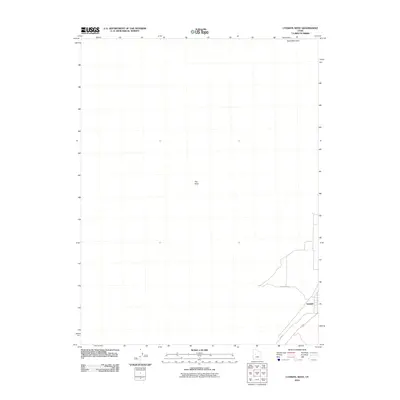
2010 Map of Lynndyl West
USGS Topo · Published 2010About this map
Lynndyl occupies the southeastern corner of this arid Millard County landscape, serving as a primary point of human activity amidst a terrain shaped by wind and sparse vegetation. The settlement's layout is grounded by local thoroughfares such as Railroad Ave and W 600 S, which define the residential and transit corridors of the community. Outside the immediate village, the topography is punctuated by prominent geological landmarks, most notably the elevated height of The Knoll near the center of the sheet. Further north, the massive expanse of Sand Mountain dominates the horizon, reflecting the desert environment of central Utah. This map effectively illustrates the isolation and focused development of a small western rail-line town at the edge of significant dune and knoll formations.
Find a feature on this map
5 named features on this map. Tap any name to fly to it.
Don’t see what you’re looking for? This feature index may not catch every label — zoom into the map to look around manually.
Map Details
Editions of this 2010 Lynndyl West Map
This is the sole edition of this map. No revisions or reprints were ever made.
Other maps of this area

1885 · Sevier Desert
USGS Topo · 1:250,000

1951 · Oak City
USGS Topo · 1:62,500

1953 · Delta
USGS Topo · 1:250,000

1958 · Delta
USGS Topo · 1:250,000

1962 · Delta
USGS Topo · 1:250,000

1962 · Lynndyl
USGS Topo · 1:62,500

1962 · Delta
USGS Topo · 1:62,500

1971 · Rain Lake
USGS Topo · 1:24,000
1971 · Desert Mtn Reservoir
USGS Topo · 1:24,000

1979 · Lynndyl
USGS Topo · 1:100,000