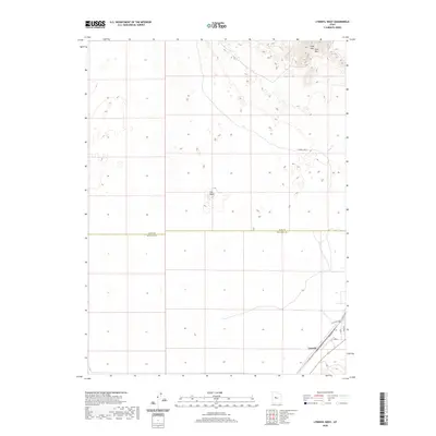
2020 Map of Lynndyl West
USGS Topo · Published 2020About this map
Lynndyl anchors the southeast corner of this desert landscape, situated at a junction of rail and road where the local infrastructure follows a strictly linear grid. The community is defined by its transit heritage, evident in the presence of Railroad Ave and Main St. Moving away from the settlement, the terrain transitions into a more sparsely developed environment marked by significant geological features like The Knoll and the sweeping elevations of the Sand Mtn Hills in the northeast.
Find a feature on this map
9 named features on this map. Tap any name to fly to it.
Don’t see what you’re looking for? This feature index may not catch every label — zoom into the map to look around manually.
Map Details
Editions of this 2020 Lynndyl West Map
This is the sole edition of this map. No revisions or reprints were ever made.
Other maps of this area

1885 · Sevier Desert
USGS Topo · 1:250,000

1951 · Oak City
USGS Topo · 1:62,500

1953 · Delta
USGS Topo · 1:250,000

1958 · Delta
USGS Topo · 1:250,000

1962 · Delta
USGS Topo · 1:250,000

1962 · Lynndyl
USGS Topo · 1:62,500

1962 · Delta
USGS Topo · 1:62,500

1971 · Rain Lake
USGS Topo · 1:24,000
1971 · Desert Mtn Reservoir
USGS Topo · 1:24,000

1979 · Lynndyl
USGS Topo · 1:100,000