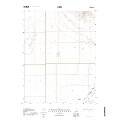
2023 Map of Lynndyl West
USGS Topo · Published 2023About this map
The high desert terrain of the eastern Sevier Desert is defined by shifting Sand Hills and the prominent rise of The Knoll near the center of this 2023 survey. This landscape straddles the boundary between Juab Co and Millard Co, capturing a transition from arid open range to the concentrated settlement at Lynndyl. The township's layout is organized around a grid including Main St and Railroad Ave, reflecting its historic orientation toward the rail lines that facilitated transport across this dry interior basin. Drainage in the area is sparse, primarily represented by the seasonal course of Tanner Creek, which meanders through the sandy flats. The map serves as a contemporary record of the intersection between human infrastructure and the desert's natural features, such as the persistent dunes that characterize the northern section.
Find a feature on this map
10 named features on this map. Tap any name to fly to it.
Don’t see what you’re looking for? This feature index may not catch every label — zoom into the map to look around manually.
Map Details
Editions of this 2023 Lynndyl West Map
This is the sole edition of this map. No revisions or reprints were ever made.
Other maps of this area

1885 · Sevier Desert
USGS Topo · 1:250,000

1951 · Oak City
USGS Topo · 1:62,500

1953 · Delta
USGS Topo · 1:250,000

1958 · Delta
USGS Topo · 1:250,000

1962 · Delta
USGS Topo · 1:250,000

1962 · Lynndyl
USGS Topo · 1:62,500

1962 · Delta
USGS Topo · 1:62,500

1971 · Rain Lake
USGS Topo · 1:24,000
1971 · Desert Mtn Reservoir
USGS Topo · 1:24,000

1979 · Lynndyl
USGS Topo · 1:100,000