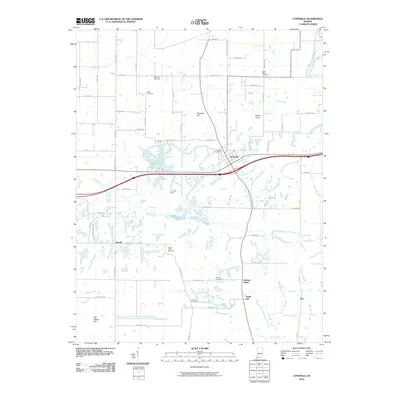
2010 Map of Lynnville
USGS Topo · Published 2010About this map
Lynnville and its surrounding countryside are defined by a mix of agricultural landscape and the footprint of heavy industry. The central portion of the sheet is dominated by the Lynnville Mine, where the topography reflects the significant land modification associated with regional coal operations. This industrial presence contrasts with the numerous family and community burial grounds scattered across the township, including Eden Cemetery, Kilpatrick Cemetery, and Saint Pauls Cemetery.
Find a feature on this map
62 named features on this map. Tap any name to fly to it.
Don’t see what you’re looking for? This feature index may not catch every label — zoom into the map to look around manually.
Map Details
Editions of this 2010 Lynnville Map
This is the sole edition of this map. No revisions or reprints were ever made.
Other maps of this area

1900 · De Gonia Springs
USGS Topo · 1:62,500

1902 · Ditney
USGS Topo · 1:125,000

1902 · Degonia Springs
USGS Topo · 1:62,500

1902 · Boonville
USGS Topo · 1:62,500

1903 · Velpen
USGS Topo · 1:62,500

1903 · Petersburg
USGS Topo · 1:62,500

1956 · Vincennes
USGS Topo · 1:250,000

1957 · Vincennes
USGS Topo · 1:250,000

1958 · Vincennes
USGS Topo · 1:250,000
1960 · De Gonia Springs
USGS Topo · 1:24,000