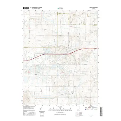
2016 Map of Lynnville
USGS Topo · Published 2016About this map
Lynnville serves as the central hub of this southwestern Indiana landscape, where the town grid is bisected by major thoroughfares and surrounded by a network of rural county roads. The terrain is defined by a series of prominent elevations and creek valleys, including Big Ditney Hill in the southwest and Dyson Knob to the northeast. The rural character is further shaped by the winding courses of Big Cr and Smith Fork, which carve through the countryside alongside small settlements like Stanley and Eby.
Find a feature on this map
88 named features on this map. Tap any name to fly to it.
Don’t see what you’re looking for? This feature index may not catch every label — zoom into the map to look around manually.
Map Details
Editions of this 2016 Lynnville Map
This is the sole edition of this map. No revisions or reprints were ever made.
Other maps of this area

1900 · De Gonia Springs
USGS Topo · 1:62,500

1902 · Ditney
USGS Topo · 1:125,000

1902 · Degonia Springs
USGS Topo · 1:62,500

1902 · Boonville
USGS Topo · 1:62,500

1903 · Velpen
USGS Topo · 1:62,500

1903 · Petersburg
USGS Topo · 1:62,500

1956 · Vincennes
USGS Topo · 1:250,000

1957 · Vincennes
USGS Topo · 1:250,000

1958 · Vincennes
USGS Topo · 1:250,000
1960 · De Gonia Springs
USGS Topo · 1:24,000