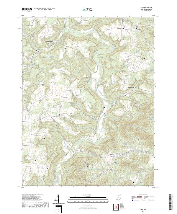
2023 Map of Lynx
USGS Topo · Published 2023About this map
Ohio Brush Creek carves a winding path through this corner of Adams County, where the township roads follow the deep drainages and ridges of the Sunfish Hills. The landscape is a network of rural settlements like Lynx and Cedar Mills, which are connected by historic routes such as Steam Furnace Rd and Paradise Valley Rd. This area reflects a long-standing pattern of upland farming and small-scale community hubs, evidenced by the high density of family-named cemeteries and rural churches marking the high ground. Notable sites like Vaughns Chapel Cem and Stone Chapel Cem indicate decades of local lineage. The topography is defined by prominent features including Greenbrier Ridge and Scrub Ridge, which dictate the flow of smaller tributaries like Easter Run and Mill Creek toward the main valley.
Find a feature on this map
110 named features on this map. Tap any name to fly to it.
Don’t see what you’re looking for? This feature index may not catch every label — zoom into the map to look around manually.
Map Details
Editions of this 2023 Lynx Map
This is the sole edition of this map. No revisions or reprints were ever made.
Other maps of this area

1916 · Peebles
USGS Topo · 1:62,500

1918 · Peebles
USGS Topo · 1:62,500

1918 · Seaman
USGS Topo · 1:62,500

1919 · Vanceburg
USGS Topo · 1:62,500

1929 · Springdale
USGS Topo · 1:48,000

1935 · Springdale
USGS Topo · 1:62,500

1949 · Vanceburg
USGS Topo · 1:62,500

1949 · Buena Vista
USGS Topo · 1:24,000

1949 · Concord
USGS Topo · 1:24,000
1951 · Buena Vista
USGS Topo · 1:24,000