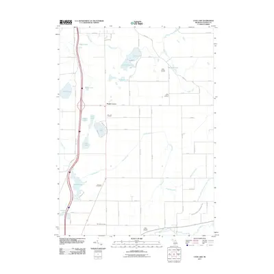
2011 Map of Lyon Lake
USGS Topo · Published 2011About this map
Lyon Lake and its surrounding agricultural landscape dominate this southern Michigan survey, where the terrain is defined by a dense cluster of small glacial lakes and an intricate system of agricultural drainage. The rural character of Calhoun County is anchored by small community hubs like Wrights Corners and preserved local history found in the Lyon Lake Cemetery, West Eckford Cemetery, and McFadden Cemetery. The map reveals a complex water management system featuring the Nottawa Drain, Goose Pond Drain, and the curiously named Clarendon and Eckford Drain Number Three, all of which service the productive farmland between the Nottawa Creek and the Saint Joseph River. Of particular interest is the Eaton Proving Grounds, a specialized industrial or testing site situated among the wetlands and woodlots north of Wilders Pond. This documentation of the modern landscape shows the persistence of early settlement patterns alongside recreational spots like Westwinds Campground and Nottawa Lake.
Find a feature on this map
59 named features on this map. Tap any name to fly to it.
Don’t see what you’re looking for? This feature index may not catch every label — zoom into the map to look around manually.
Map Details
Editions of this 2011 Lyon Lake Map
This is the sole edition of this map. No revisions or reprints were ever made.
Other maps of this area

1918 · Battle Creek
USGS Topo · 1:62,500

1918 · Union City
USGS Topo · 1:62,500

1921 · Marshall
USGS Topo · 1:62,500

1923 · Marshall
USGS Topo · 1:62,500

1943 · Battle Creek
USGS Topo · 1:62,500

1943 · Marshall
USGS Topo · 1:62,500

1947 · Ceresco
USGS Topo · 1:24,000

1947 · Union City
USGS Topo · 1:62,500

1948 · Homer
USGS Topo · 1:62,500

1949 · Homer
USGS Topo · 1:62,500