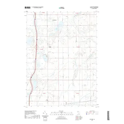
2019 Map of Lyon Lake
USGS Topo · Published 2019About this map
Marshall anchors the northern edge of this landscape, where the southern outskirts of the city give way to the glacial lake plains of Calhoun County. The area is defined by a dense network of kettle lakes and wetlands, including the prominent Lyon Lake and the marshy reaches of Nottawa Lake. This 2019 survey illustrates a rural grid of numbered mile roads and lettered drives, such as Division Dr and F Dr S, which connect longstanding agricultural communities. Local history is well-preserved in several small burial sites scattered across the townships, from the Lyon Lake Cem near Wrights Corners to the secluded McFadden Burial Ground Cem. To the south, the terrain drains toward the Saint Joseph River, following the paths of engineered waterways like the Clarendon and Eckford Drain Number Three and natural streams like Wilder Cr.
Find a feature on this map
70 named features on this map. Tap any name to fly to it.
Don’t see what you’re looking for? This feature index may not catch every label — zoom into the map to look around manually.
Map Details
Editions of this 2019 Lyon Lake Map
This is the sole edition of this map. No revisions or reprints were ever made.
Other maps of this area

1918 · Battle Creek
USGS Topo · 1:62,500

1918 · Union City
USGS Topo · 1:62,500

1921 · Marshall
USGS Topo · 1:62,500

1923 · Marshall
USGS Topo · 1:62,500

1943 · Battle Creek
USGS Topo · 1:62,500

1943 · Marshall
USGS Topo · 1:62,500

1947 · Ceresco
USGS Topo · 1:24,000

1947 · Union City
USGS Topo · 1:62,500

1948 · Homer
USGS Topo · 1:62,500

1949 · Homer
USGS Topo · 1:62,500