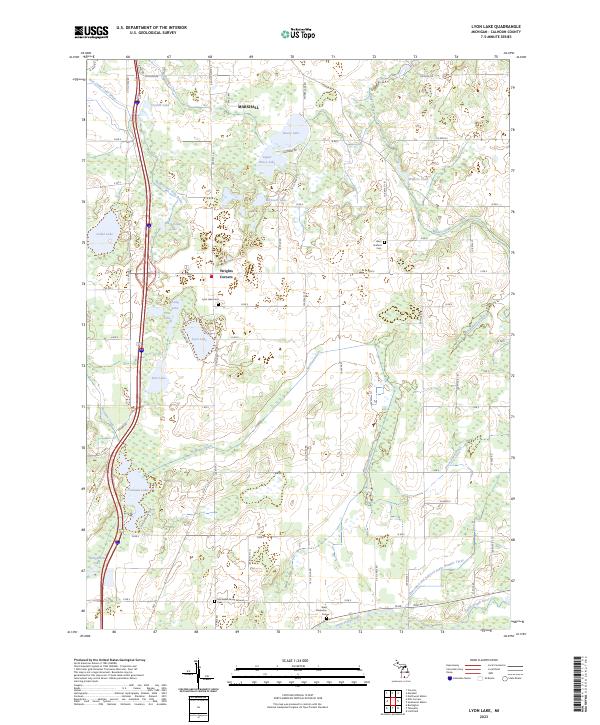
2023 Map of Lyon Lake
USGS Topo · Published 2023About this map
Lyon Lake and its neighboring waters define this section of Calhoun County south of Marshall. The landscape is heavily marked by a complex system of agricultural and natural waterways, including the Nottawa Drain, Goose Pond Drain, and the East Cedar Lake Drain, all flowing through the glacial terrain. In the southern portion of the map, the Saint Joseph River meanders eastward, bordered by the West Clarendon Cem. For local historians and genealogists, the map identifies several distinct burial sites such as the McFadden Burial Ground Cem and Lyon Lake Cem near Wrights Corners. The infrastructure is characterized by a precise grid of rural roads like 17 Mile Rd and Division Dr, which connect these small settlements and historic family-named cemeteries across the townships of Eckford, Fredonia, and Clarendon.
Find a feature on this map
73 named features on this map. Tap any name to fly to it.
Don’t see what you’re looking for? This feature index may not catch every label — zoom into the map to look around manually.
Map Details
Editions of this 2023 Lyon Lake Map
This is the sole edition of this map. No revisions or reprints were ever made.
Other maps of this area

1918 · Battle Creek
USGS Topo · 1:62,500

1918 · Union City
USGS Topo · 1:62,500

1921 · Marshall
USGS Topo · 1:62,500

1923 · Marshall
USGS Topo · 1:62,500

1943 · Battle Creek
USGS Topo · 1:62,500

1943 · Marshall
USGS Topo · 1:62,500

1947 · Ceresco
USGS Topo · 1:24,000

1947 · Union City
USGS Topo · 1:62,500

1948 · Homer
USGS Topo · 1:62,500

1949 · Homer
USGS Topo · 1:62,500