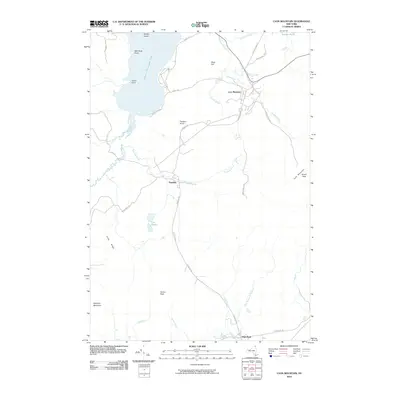
2010 Map of Lyon Mountain
USGS Topo · Published 2010About this map
Lyon Mountain sits at the heart of this survey of the northern reaches of Adirondack Park, where the local landscape is defined by high peaks and an intricate network of mountain streams. The settlement of Lyon Mountain and the smaller hamlet of Standish are connected by Standish Rd, tracing a corridor through the high country between Parsons Knob and Averill Peak. The northwestern corner of the quadrangle is dominated by the waters of Upper Chateaugay Lake, featuring landmarks like Split Rock Point, Indian Point, and Moffitt Island. The drainage patterns are clearly visible, with Standish Brook, Separator Brook, and Brandy Brook flowing from the heights. To the south, the topography descends toward High Bank along True Brook Rd, while more isolated water bodies like Twin Ponds and Bradley Pond remain tucked between the ridges of Piney Ridge and Haystack Mountain.
Find a feature on this map
34 named features on this map. Tap any name to fly to it.
Don’t see what you’re looking for? This feature index may not catch every label — zoom into the map to look around manually.
Map Details
Editions of this 2010 Lyon Mountain Map
This is the sole edition of this map. No revisions or reprints were ever made.
Other maps of this area

1906 · Loon Lake
USGS Topo · 1:62,500

1908 · Loon Lake
USGS Topo · 1:62,500

1911 · Lyon Mountain
USGS Topo · 1:62,500

1913 · Lyon Mountain
USGS Topo · 1:62,500

1915 · Churubusco
USGS Topo · 1:62,500

1915 · Chateaugay
USGS Topo · 1:62,500

1931 · Lyon Mountain
USGS Topo · 1:62,500

1943 · Churubusco
USGS Topo · 1:62,500

1943 · Chateaugay
USGS Topo · 1:62,500

1948 · Ogdensburg
USGS Topo · 1:250,000