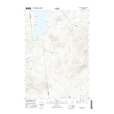
2016 Map of Lyon Mountain
USGS Topo · Published 2016About this map
The rugged highlands of the northern Adirondack Park Preserve dominate this 2016 survey, where the peaks of Lyon Mountain and Averill Peak rise above the surrounding forests. The settlement of Standish sits in the valley of Standish Brook, marked by its historic street grid including Depot St, while the community of Lyon Mountain is situated to the northeast along the slopes. This landscape is defined by its dramatic relief and water systems, with the southern reach of Upper Chateaugay Lake stretching into the northwest corner near Split Rock Point. The map provides a detailed view of the drainage patterns through the mountains, tracing the courses of Separator Brook, Brandy Brook, and Cold Brook. To the south and west, the terrain rises again toward Norton Peak and Haystack Mtn, separated by the lower elevations of Piney Ridge.
Find a feature on this map
45 named features on this map. Tap any name to fly to it.
Don’t see what you’re looking for? This feature index may not catch every label — zoom into the map to look around manually.
Map Details
Editions of this 2016 Lyon Mountain Map
This is the sole edition of this map. No revisions or reprints were ever made.
Other maps of this area

1906 · Loon Lake
USGS Topo · 1:62,500

1908 · Loon Lake
USGS Topo · 1:62,500

1911 · Lyon Mountain
USGS Topo · 1:62,500

1913 · Lyon Mountain
USGS Topo · 1:62,500

1915 · Churubusco
USGS Topo · 1:62,500

1915 · Chateaugay
USGS Topo · 1:62,500

1931 · Lyon Mountain
USGS Topo · 1:62,500

1943 · Churubusco
USGS Topo · 1:62,500

1943 · Chateaugay
USGS Topo · 1:62,500

1948 · Ogdensburg
USGS Topo · 1:250,000